Project Title:
Analyzing the ability of maximum likelihood, support vector machine, and random forest algorithms in land use classification with the help of Google Earth ground truth data
Project Description:
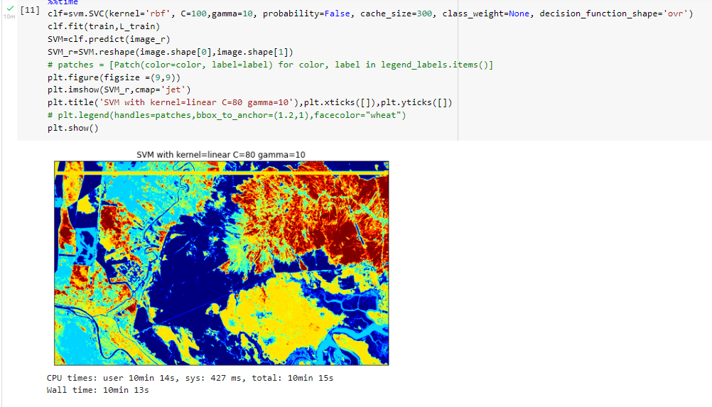
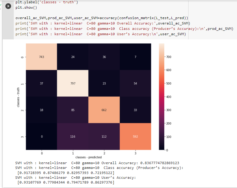
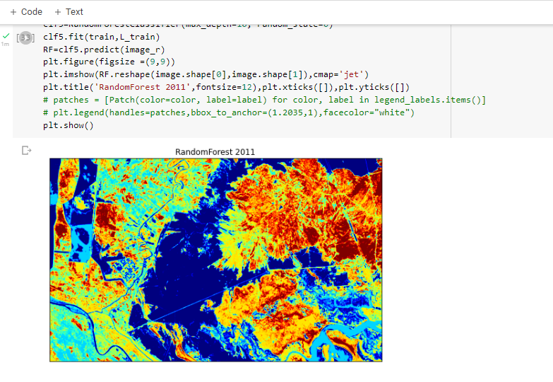
Employing Google Earth, precise delineation of the region of interest was achieved. Subsequently, image classification was conducted within the Python programming environment, utilizing SVM, random forest, and maximum likelihood algorithms.
Project Details:
- Industry : Class Project
- Tools : Python, Google Earth Engine, ENVI
- Date : 5 - 1 - 2022
- URL : https://colab.research.google.com/drive/1dSv9iuuC0sqPrFKpmqoHxf2nw1pvT2jE