Landslide Detection Using AI and Satellite Imagery
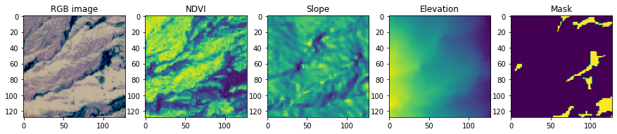
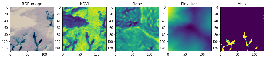
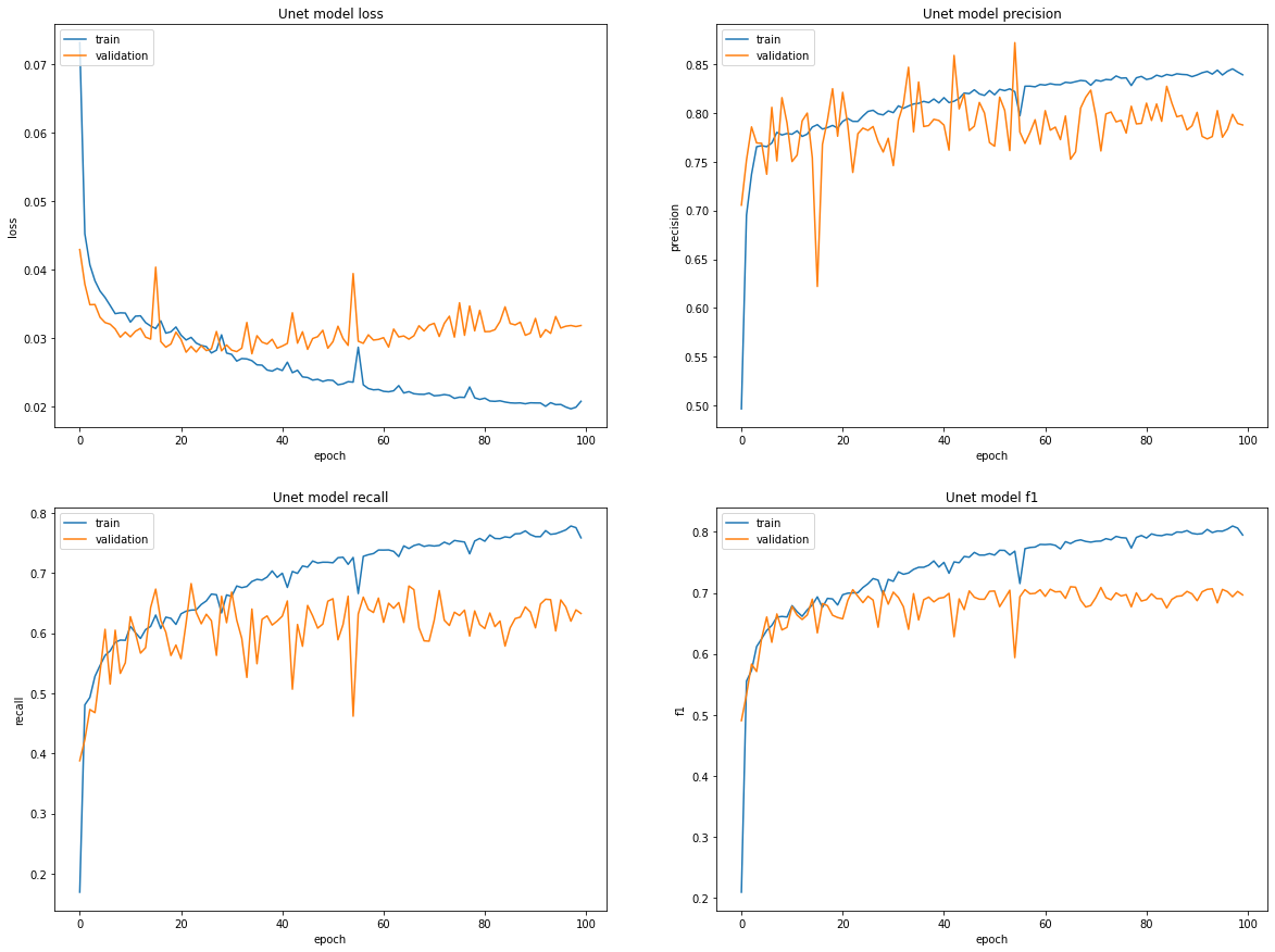
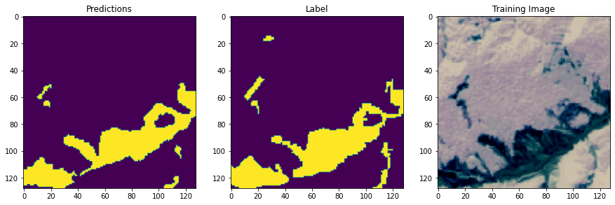
This project focuses on the automatic detection of landslides using high-resolution satellite imagery and deep learning. To improve accuracy, I combined multiple data sources — including RGB bands, NDVI vegetation index, and topographic features like slope and elevation — allowing the model to better understand both surface conditions and terrain. I compared several state-of-the-art neural network architectures, including U-Net, ResUNet++, and Attention U-Net. Building on their strengths, I proposed a new model — SEA-UNet — which enhances U-Net with Squeeze-and-Excitation (SE) attention modules and dense skip connections. This model, developed as part of my thesis, achieved the best results, outperforming all baselines in both mean Intersection over Union (mIoU) and F1-score. On this page, you'll find a selection of visual results showing the model’s predictions overlaid on satellite images — highlighting how deep learning can help monitor and understand landslide-prone areas more effectively. Data are collected from GoeDev.
- Industry : Working Projects
- Tools : Python (Colab) , ENVI, ArcGIS
- Date : 1 - 6 - 2025
- URL : #